Randonnée Marche Les Plantiers - Les Plantiers et st Marcel de Fontfouillouse - Photo

Les Plantiers et st Marcel de Fontfouillouse

 randotines
randotines

Utilisateur GUIDE

© OpenStreetMap contributors
Longueur
Longueur
13,6 km
Altitude max
Altitude max
909 m
Dénivelé positif
Dénivelé positif
549 m
Km-Effort
Km-Effort  
21 km
Altitude min
Altitude min
408 m
Dénivelé négatif
Dénivelé négatif
549 m
Boucle
Boucle
Oui
Date de création :
2014-12-10 00:00:00.0
Dernière modification :
2014-12-10 00:00:00.0

(1 Avis)

Marche
Marche
4h33
Difficulté : Difficile

Scannez ce code QR pour ouvrir la randonnée dans l'application SityTrail

Application GPS de randonnée GRATUITE

Logo SityTrail SityTrail

IGN / Instituts géographiques

Télécharger SityTrail sur l'App Store Télécharger SityTrail sur Google Play

Logo SityTrail SityTrail World

Le monde est à vous

Télécharger SityTrail sur l'App Store Télécharger SityTrail sur Google Play Télécharger SityTrail sur Huawei AppGallery

À propos

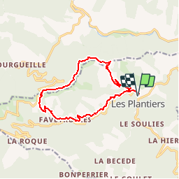
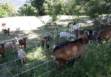
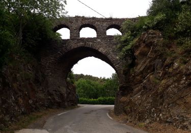
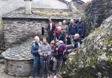
Randonnée Marche de 13,6 km à découvrir à Occitanie, Gard, Les Plantiers. Cette randonnée est proposée par randotines.

Profil altimétrique

Localisation

Pays :
France
Région :
Occitanie
Département/Province :
Gard
Commune :
Les Plantiers
Localité :
Unknown
Départ:(Dec)
Départ:(UTM)
557829 ; 4885190 (31T) N.

Commentaires

Veuillez vous connecter pour laisser un commentaire ou une note


Super tracé!!!!


Randonnées à proximité

Randonnée Marche Saint-André-de-Valborgne - Sentier du col Salidès - Saint André de Valborgne - Photo
Marche
tracegps

Marche

Très difficile
(2)
Saint-André-de-Valborgne, Occitanie, Gard, France
18 km | 28 km-effort
6h 0min
Oui
Randonnée Marche Les Plantiers - Sentier de Saint Marcel de Fontfouillouse -  Les Plantiers - Photo
Marche
tracegps

Marche

Très difficile
(1)
Les Plantiers, Occitanie, Gard, France
13,6 km | 21 km-effort
4h 0min
Oui
Randonnée Marche Saint-André-de-Valborgne - Col du Salidès  - Photo
Marche
GUIDE
nadinebondoux

Marche

Difficile
Saint-André-de-Valborgne, Occitanie, Gard, France
18,9 km | 28 km-effort
5h 32min
Oui
Randonnée Marche Les Plantiers - Vallée Borgne - Photo
Marche
GUIDE
nadinebondoux

Marche

Difficile
Les Plantiers, Occitanie, Gard, France
19,7 km | 32 km-effort
5h 19min
Oui
Randonnée Marche Saumane - Exil / pont des chèvres  - Photo
Marche
GUIDE
nadinebondoux

Marche

Difficile
Saumane, Occitanie, Gard, France
17,3 km | 27 km-effort
5h 53min
Oui
Randonnée Marche Les Plantiers - vallée Borgne - Photo
Marche
GUIDE
nadinebondoux

Marche

Difficile
Les Plantiers, Occitanie, Gard, France
25 km | 36 km-effort
6h 15min
Oui
Randonnée Marche Saint-André-de-Valborgne - vallée Borgne - Photo
Marche
GUIDE
nadinebondoux

Marche

Difficile
Saint-André-de-Valborgne, Occitanie, Gard, France
18,7 km | 30 km-effort
5h 44min
Oui
Randonnée Marche Saint-André-de-Valborgne - vallée Borgne - Photo
Marche
GUIDE
nadinebondoux

Marche

Difficile
Saint-André-de-Valborgne, Occitanie, Gard, France
18,7 km | 30 km-effort
5h 44min
Oui
Randonnée Marche Les Plantiers - Sentier du Mouflon - Les Plantiers  - Photo
Marche
GUIDE
randotines

Marche

Difficile
Les Plantiers, Occitanie, Gard, France
11,2 km | 18,6 km-effort
3h 30min
Oui


Fermer
Mes abonnements